History
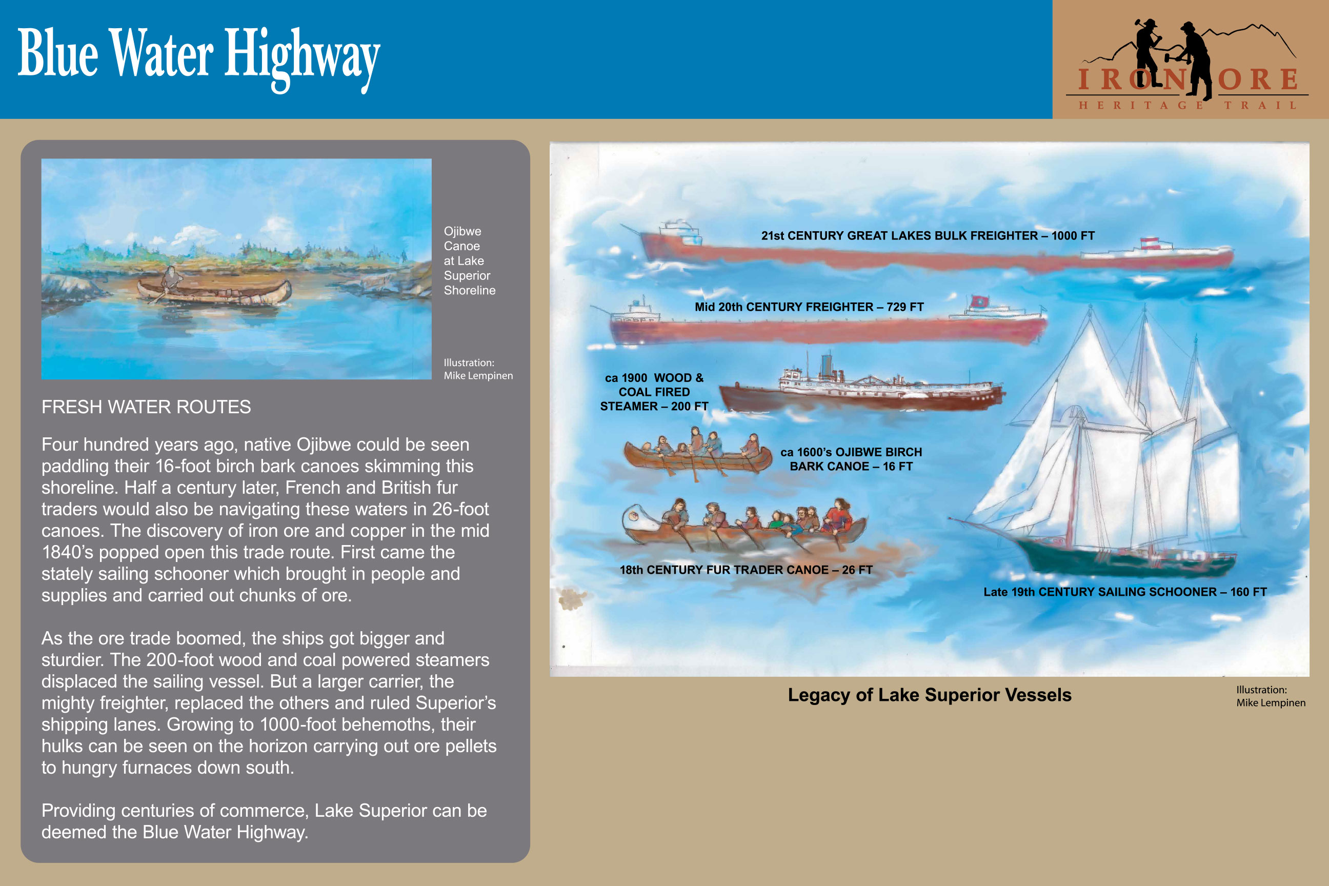
Blue Water Highway
Providing centuries of commerce, Lake Superior can be deemed the Blue Water Highway. This sign found near mile marker 41 near the MDOT Welcome Center, US 41 South.
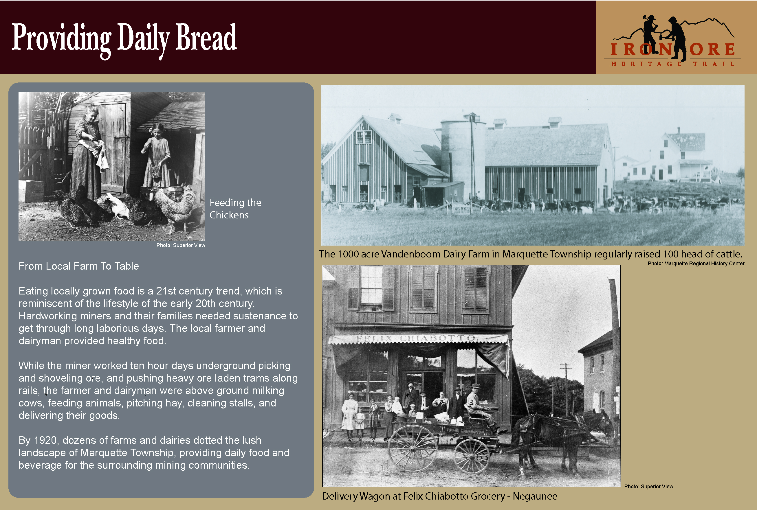
Providing Daily Bread
While the miner worked ten hour days underground picking and shoveling ore and pushing heavy ore laden trams along rails, the farmer and dairyman were above ground milking cows, feeding animals, pitching hay, cleaning stalls, and delivering their goods. This sign found mile marker 34.5 at the Schwemwood Trail head in Marquette Township (just west of CR492).
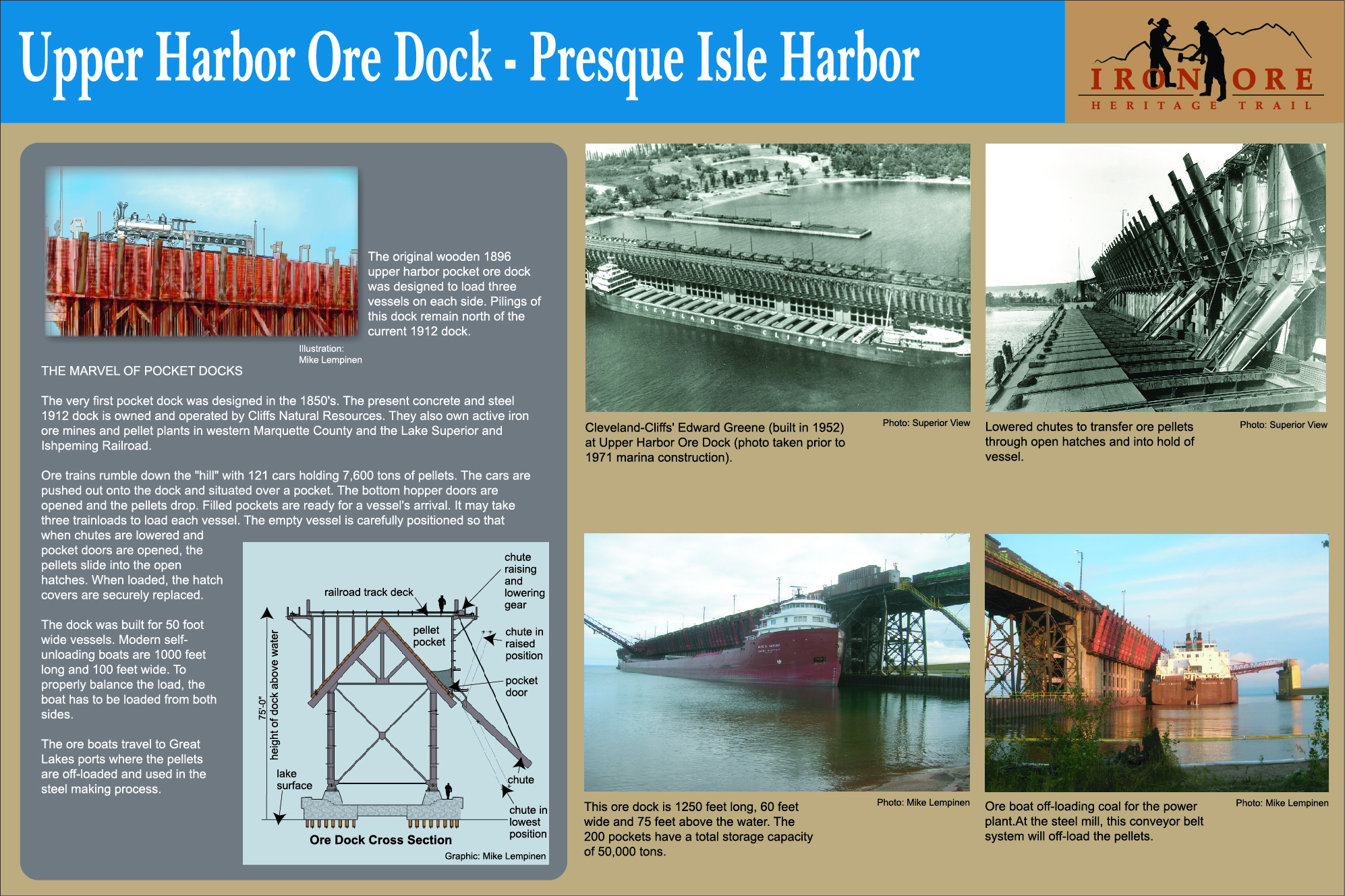
The Marvel of Pocket Docks
The very first pocket dock was designed in the 1850’s. The present concrete and steel 1912 dock is owned and operated by Cliffs Natural Resources. They also own active iron ore mines and pellet plants in western Marquette County and the Lake Superior & Ishpeming Railroad. This sign found on Presque Isle near the engine display and Upper Harbor Ore Dock.
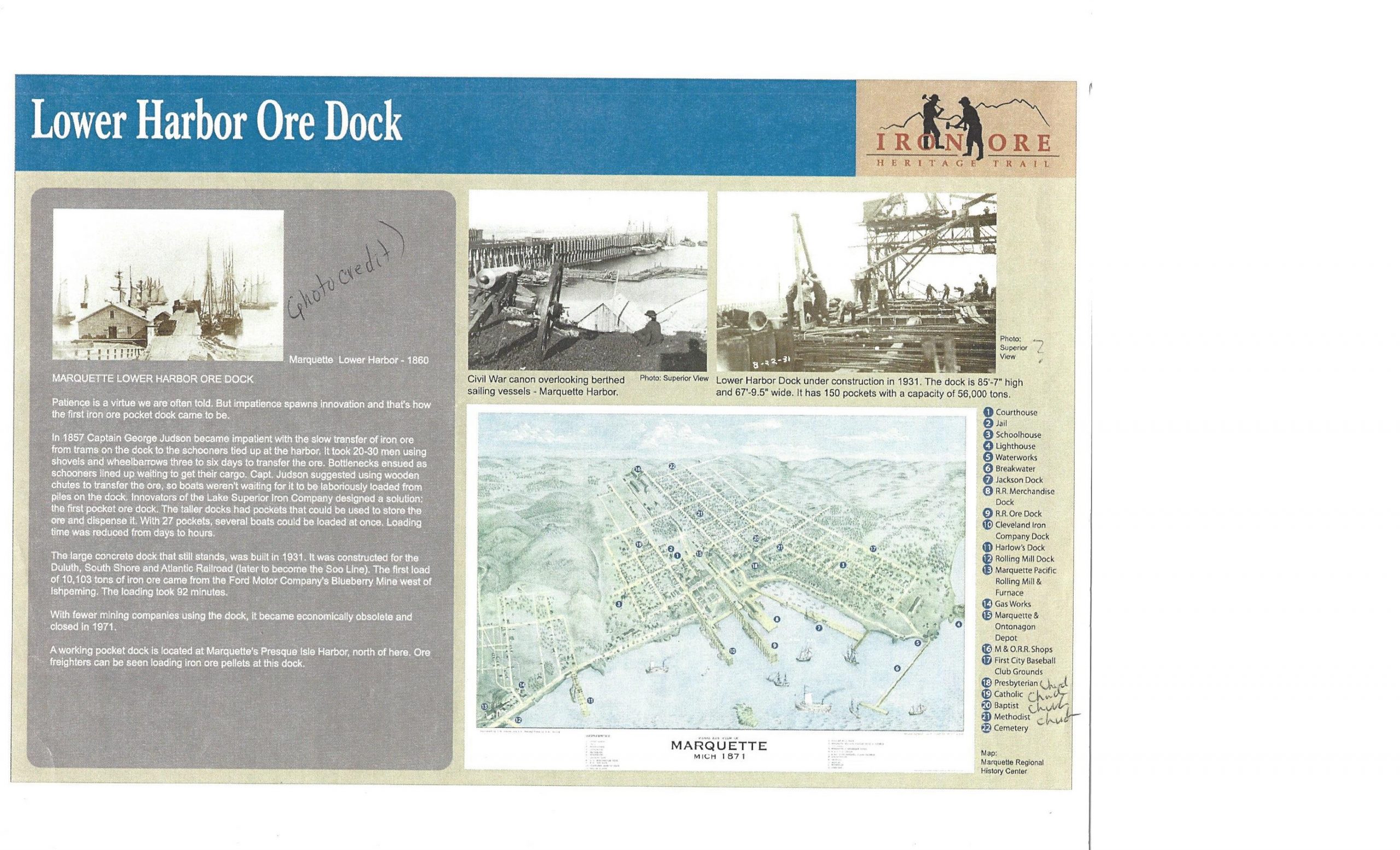
Lower Harbor Ore Dock
The large concrete dock that still stands was built in 1931. It was constructed for the Duluth, South Shore and Atlantic Railroad (later to become the Soo Line). The first load of 10,103 tons of iron ore came from the Ford Motor Company’s Blueberry Mine west of Ishpeming. The loading took 92 minutes.
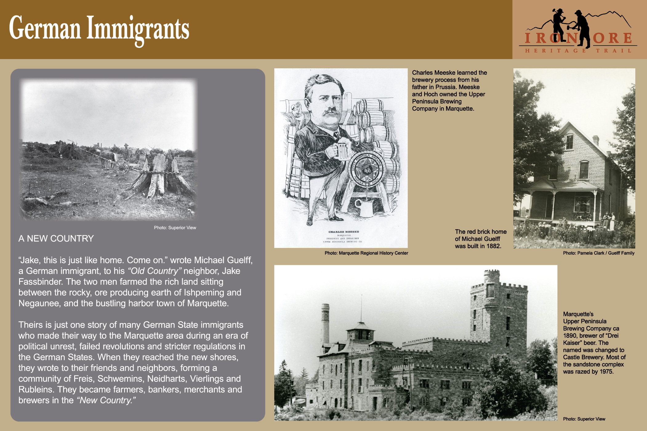
German Immigrants
“Jake, this is just like home. Come on,” wrote Michael Guelff, a German immigrant, to his “Old Country” neighbor, Jake Fassbender. The two men farmed the rich land sitting between the rocky, ore producing earth of Ishpeming and Negaunee, and the bustling harbor town of Marquette. This sign found near mile marker 34.5 at the Schwemwood Trailhead in Marquette Township (just west of CR 492)
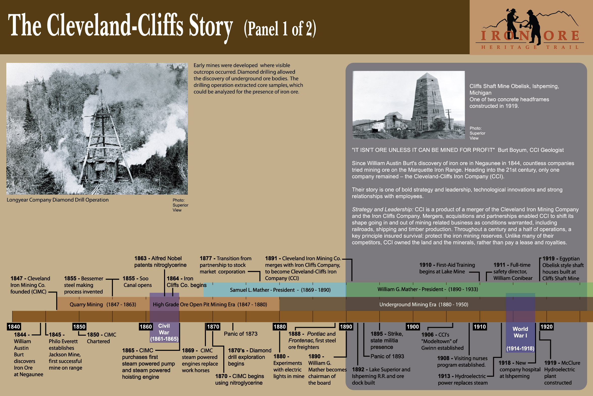
Cleveland Cliffs
“It isn’t ore unless it can be mined for a profit,” Burt Boyum, CCI Geologist
Since William Austin Burt’s discovery of iron ore in Negaunee in 1844, countless companies tried mining ore on the Marquette Iron Range. Heading into the 21st century, only one company remained—the Cleveland-Cliffs Iron Company (CCI). This sign found at the Ishpeming Trailhead at Lake Bancroft Mining Heritage Pavilion, Euclid Street. Adjacent to Cliffs Shaft Mine Museum
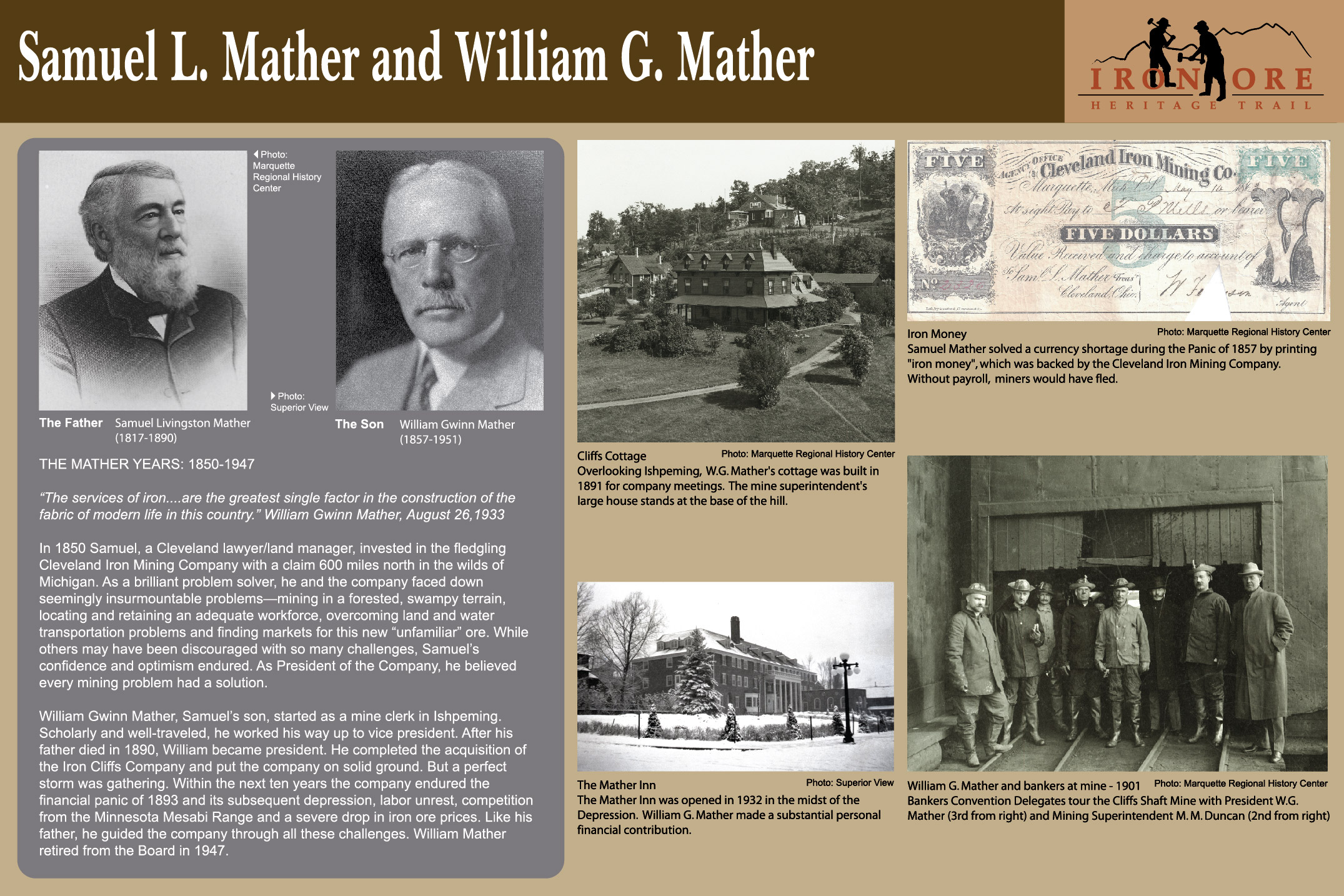
Mather Men
“The services of iron…are the greatest single factor in the construction of the fabric of modern life in this country.” William Gwinn Mather, August 26, 1933
Samuel and William Mather devoted their lives and fortunes to these iron mines for nearly a century. This sign found at the Ishpeming trailhead, Bancroft Pavilion on Euclid Street, Ishpeming (adjacent to Cliffs Shaft Mine Museum)
Open Under Open
Following the Veins of Ore
Like a little girl overwhelmed by a large blueberry patch, the early miners must have thought the iron ore would last forever. They worked the exposed outcrops with picks and shovels. This sign is found at mile marker 19.75, near Exelsior Street in Ishpeming.
Transportation of the Iron Ore
“We want a plank road!”
At first, iron ore laden wagons and sleighs slogged through mud and snow down the treacherous 12-mile wagon trail to the lakeshore. In 1852, local agent, Tower Jackson, wrote “We want a plank road!” to his superiors at the Cleveland Iron Mining Company. This sign found at mile marker 24.5 on kiosk at Negaunee Miners Park, Negaunee Trailhead.
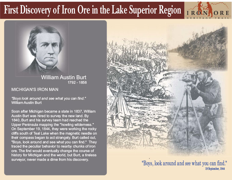
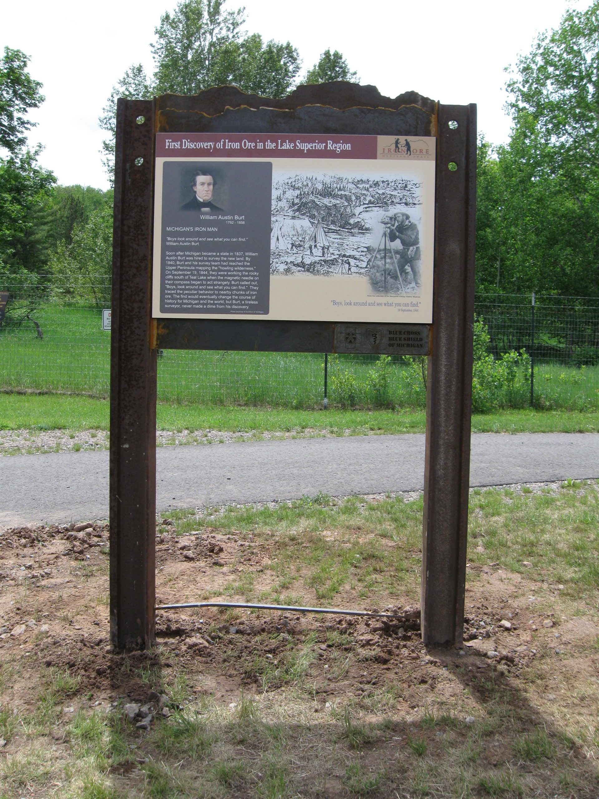
First Discovery of Iron Ore in the Lake Superior Region
Michigan’s Iron Man – William Austin Burt 1792 – 1858
Soon after Michigan became a state in 1837, William Austin Burt was hired to survey the new land. By 1840, Burt and his survey team had reached the Upper Peninsula mapping the “howling wilderness.” This sign is found at the Negaunee trailhead, mile marker 24.5, in Jackson Miner Park.
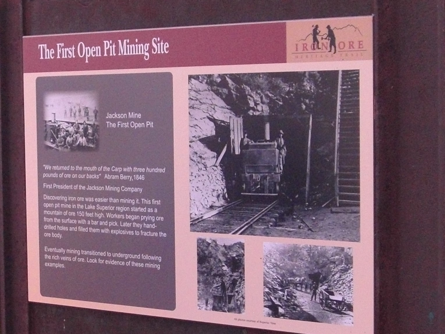
The First Open Pit Mining Site – The Jackson Mine
Discovering iron ore was easier than mining it. This first open pit mine in the Lake Superior region started as a mountain of ore 150 feet high. Workers began prying ore from the surface with a bar and pick. Later they hand- drilled holes and filled them with explosives to fracture the ore body. This sign found at mile marker 24, west of the Negaunee trailhead.
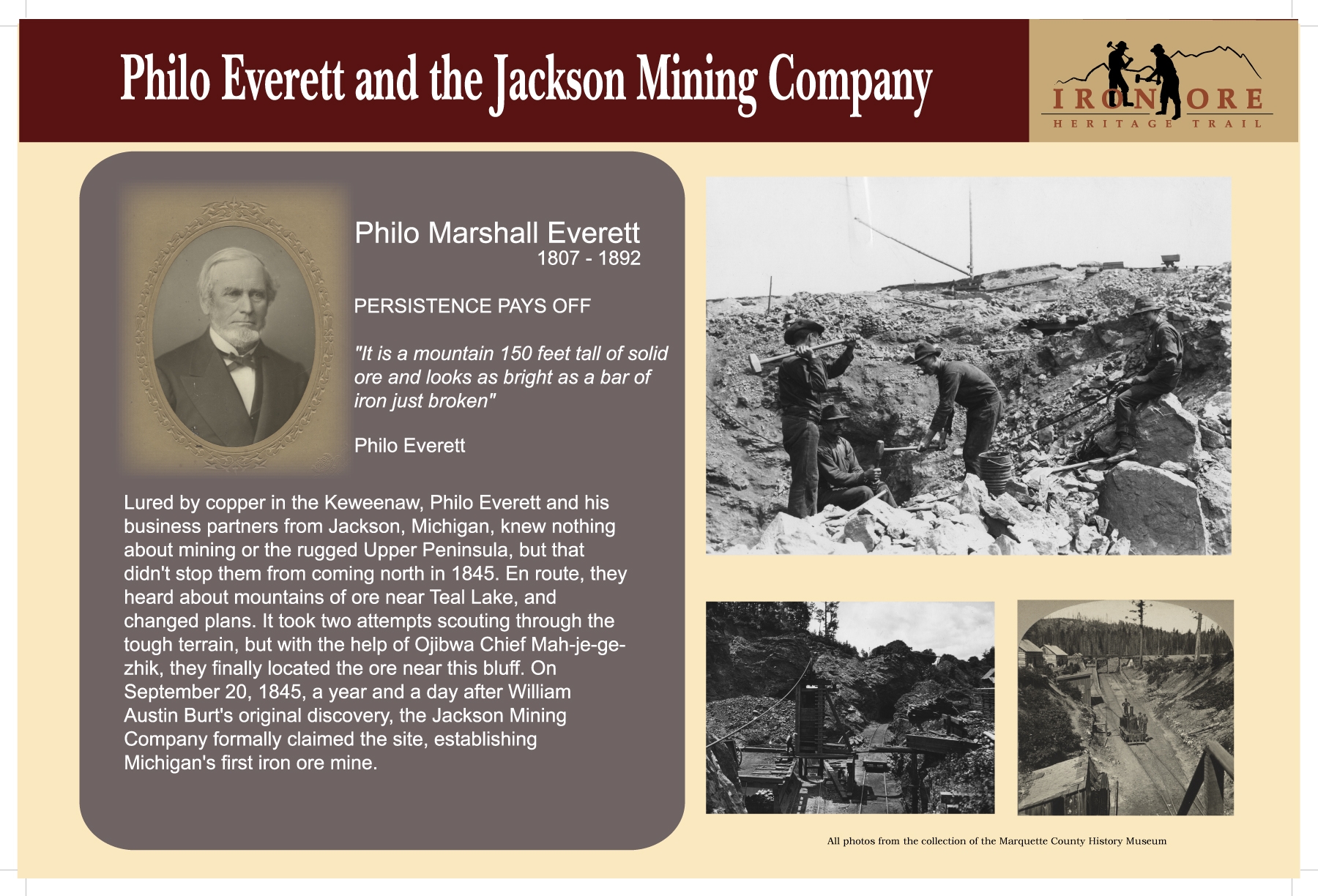
Philo Everett and the Jackson Mining Company
Philo Marshall Everett 1807 – 1892
Lured by copper in the Keweenaw, Philo Everett and his business partners from Jackson, Michigan, knew nothing about mining or the rugged Upper Peninsula, but that didn’t stop them from coming north in 1845. This sign found at mile marker 24, west of the Negaunee trailhead.
Men Before Machines – The First Open Pit
The Jackson Mine started with fewer than a dozen men working the crude quarry. Some of the first to work here came from the tin mines of Cornwall. They brought double-jacking, a method for hand-drilling that required three men; two to hammer with sledges while a third– often just a boy–held the drill. Mining was dirty, dangerous, and backbreaking work. This sign is found near mile marker 24 at the Jackson Mine Pit #1.
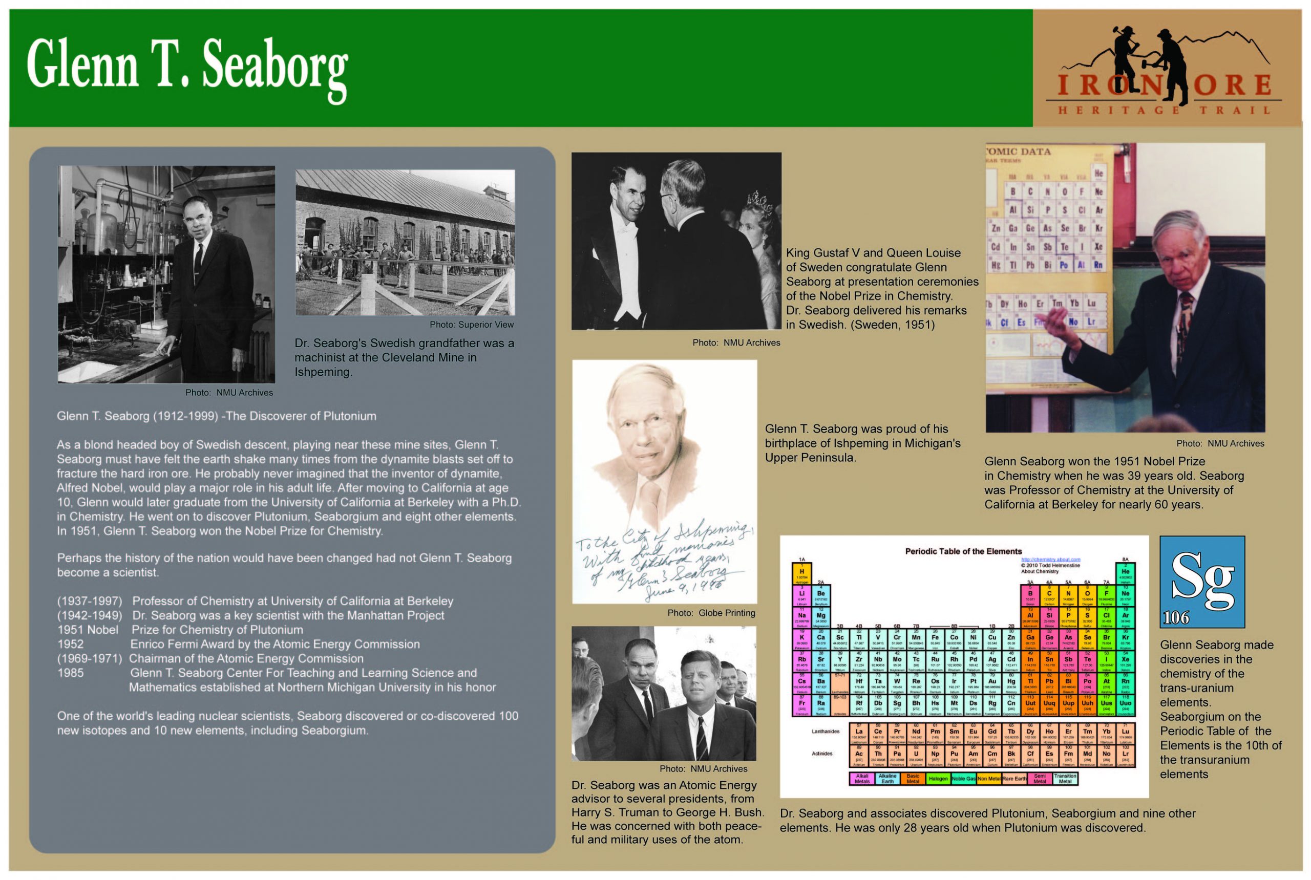
Glenn T. Seaborg - The Discoverer of Plutonium
As a boy, Glenn T. Seaborg must have felt the earth shake many times from the dynamite blasts set off to fracture the hard iron ore. He probably never imagined that the inventor of dynamite, Alfred Nobel, would play a major role in his life. Glenn moved to California at age 10 and later graduated with a Ph.D. in Chemistry from the University of California, Berkeley. He went on to discover Plutonium, Seaborgium and 8 other elements. In 1951, Seaborg won the Nobel Prize for Chemistry. This sign is located at mile marker 22, the spur trail leading from main trail to Division Street in Ishpeming.
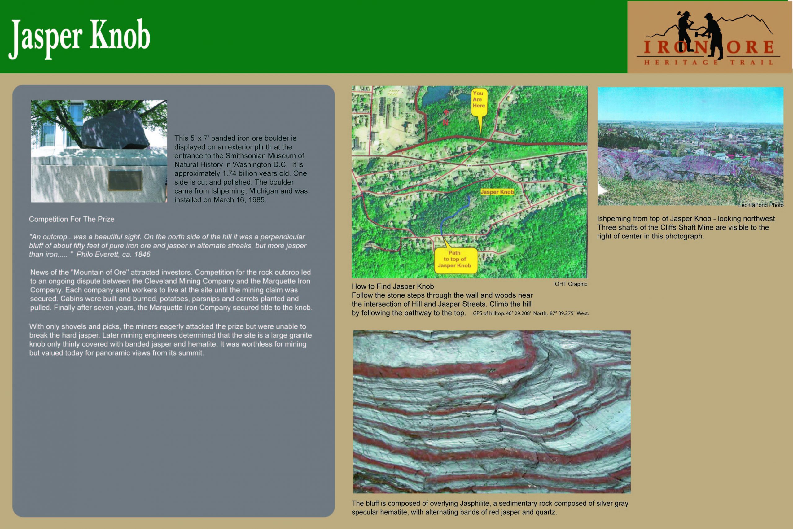
Jasper Knob– Competition for the Prize
News of the “Mountain of Ore” attracted investors. Competition for the rock outcrop led an ongoing dispute between the Cleveland Mining Company and the Marquette Iron Company. Each company sent workers to live at the site until the mining claim was secured. Cabins were built and burned, potatoes, parsnips and carrots planted and pulled. Finally after seven years, the Marquette Iron Company secured title to the knob. This sign is located at mile marker 22.25 at corner of Davis Street in Ishpeming.
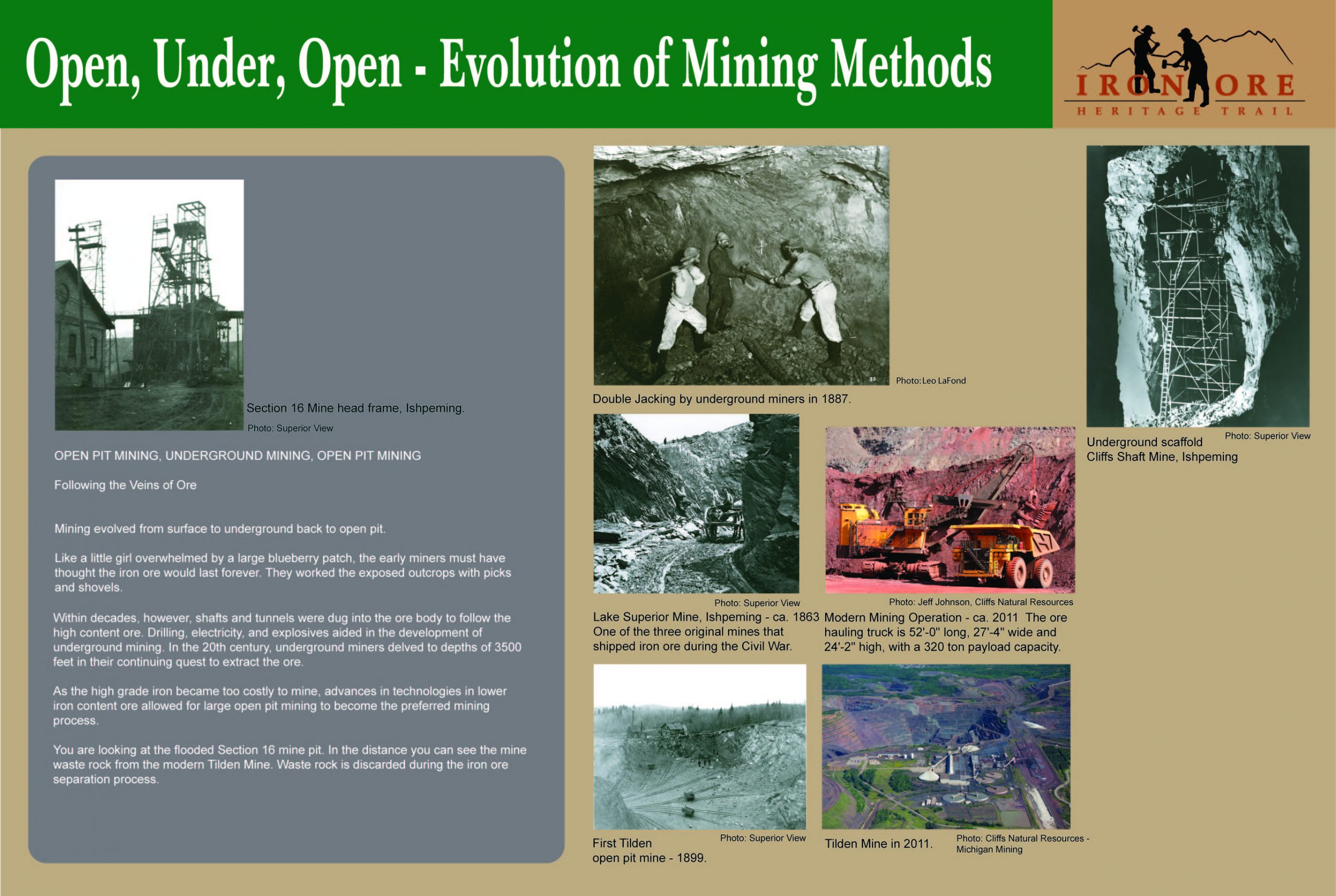
Evolution of Mining Methods– Following the Veins of Ore
Mining evolved from surface to underground back to open pit. Within decades, shafts and tunnels were dug into the ore body to follow the high content ore. Drilling, electricity, and explosives aided in the development of underground mining. In the 20th century, underground miners delved to depths of 3500 feet in their continuing quest to extract the ore. This sign is found near mile marker 19.75, south of Exelsior Street in Ishpeming.
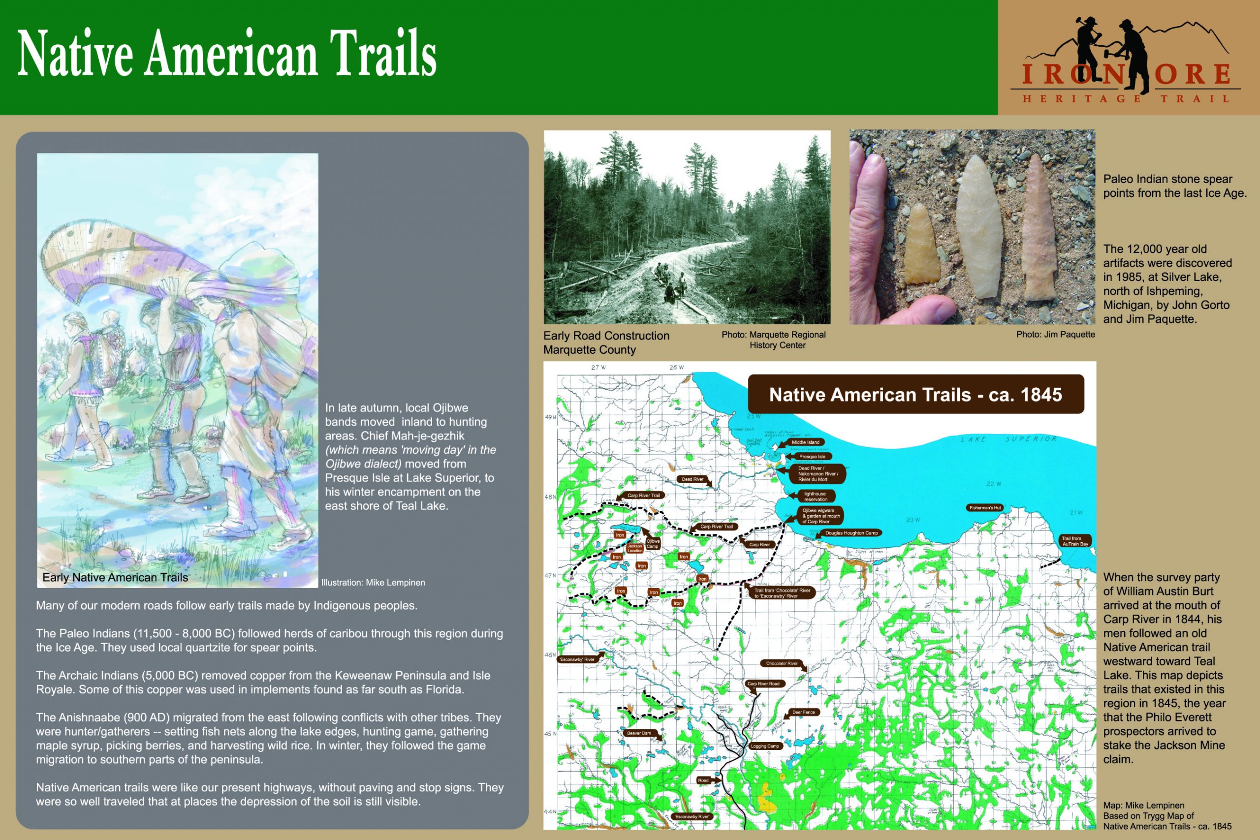
Native American Trails
Many of our modern roads follow early trails made by indigenous peoples. Native American trails were like our present highways, without paving and stop signs. They were so well traveled that at places the depression of the soil is still visible. This sign is located at mile marker 24, near the Jackson Mine in Negaunee.
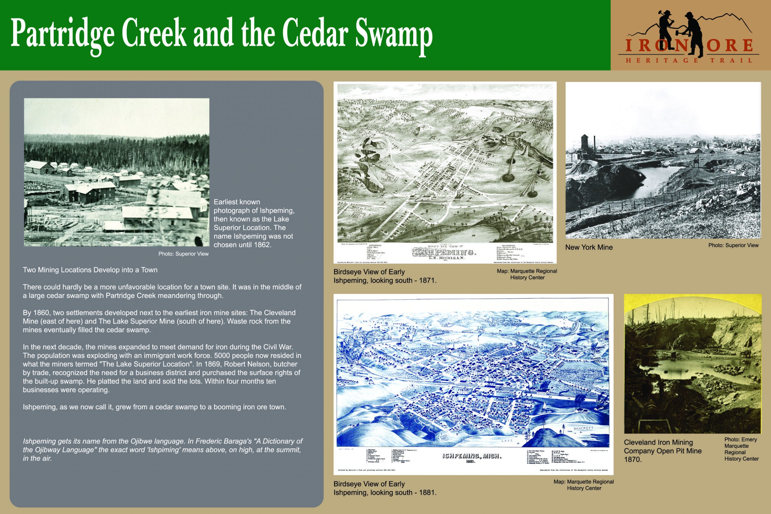
Partridge Creek and the Cedar Swamp
There could hardly be a more unfavorable location for a town site. It was in the middle of a large cedar swamp with Partridge Creek meandering through. By 1860, two settlements developed next to the earliest iron mine sites: The Cleveland Mine and The Superior Mine. Waste rock from the mines eventually filled the cedar swamp. This sign is located near mile marker 21, across from the Ishpeming Post office between 1st and 2nd Streets.
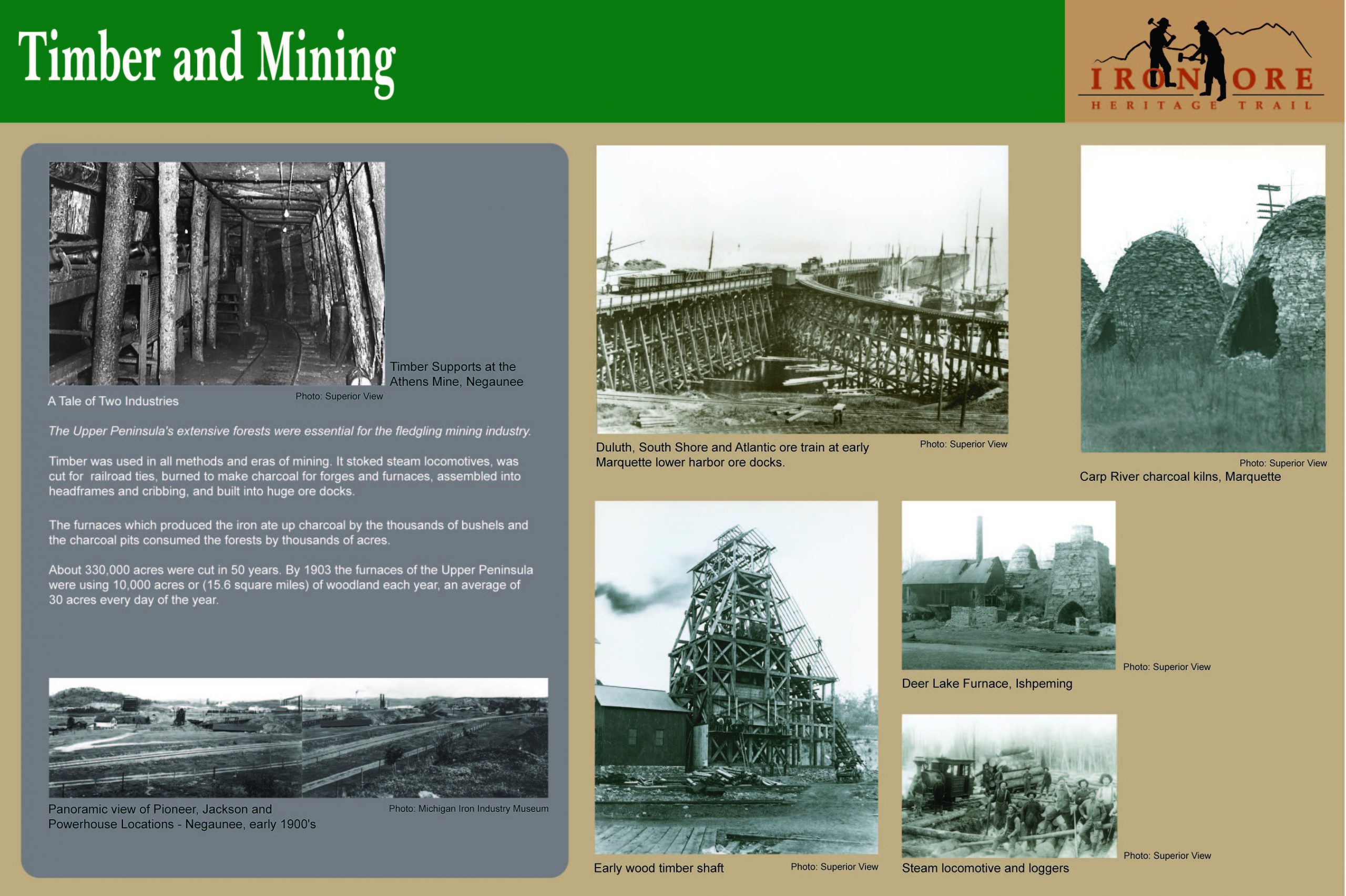
Timber and Mining– A Tale of Two Industries
Timber was used in all methods and eras of mining. It stoked steam locomotives, was cut for railroad ties, burned to make charcoal for forges and furnaces, assembled into headframes and cribbing, and built into huge ore docks. This sign is located near mile marker 23.5 west of the Jackson Mine in Negaunee.
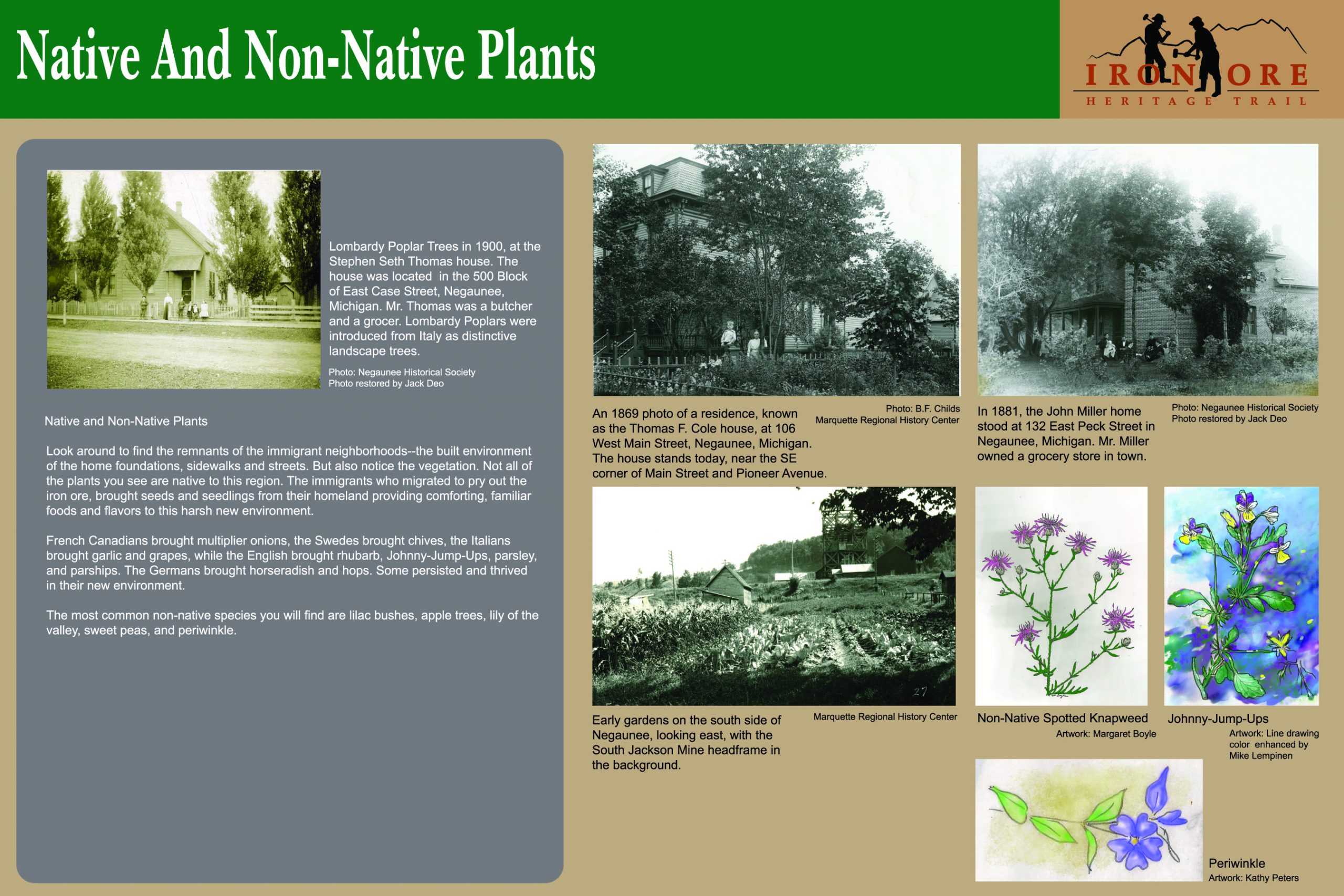
Native and Non-Native Plants
Look around to find the remnants of the immigrant neighborhoods – the built environment of the home foundations, sidewalks and streets. But also notice the vegetation. Not all of the plants you see are native to this region. The immigrants who migrated to pry out the iron ore, brought seeds and seedlings from their homeland providing comforting, familiar foods and flavors to this harsh new environment. This sign is located near mile marker 23.5 in Negaunee just west of the Jackson Mine Pit.
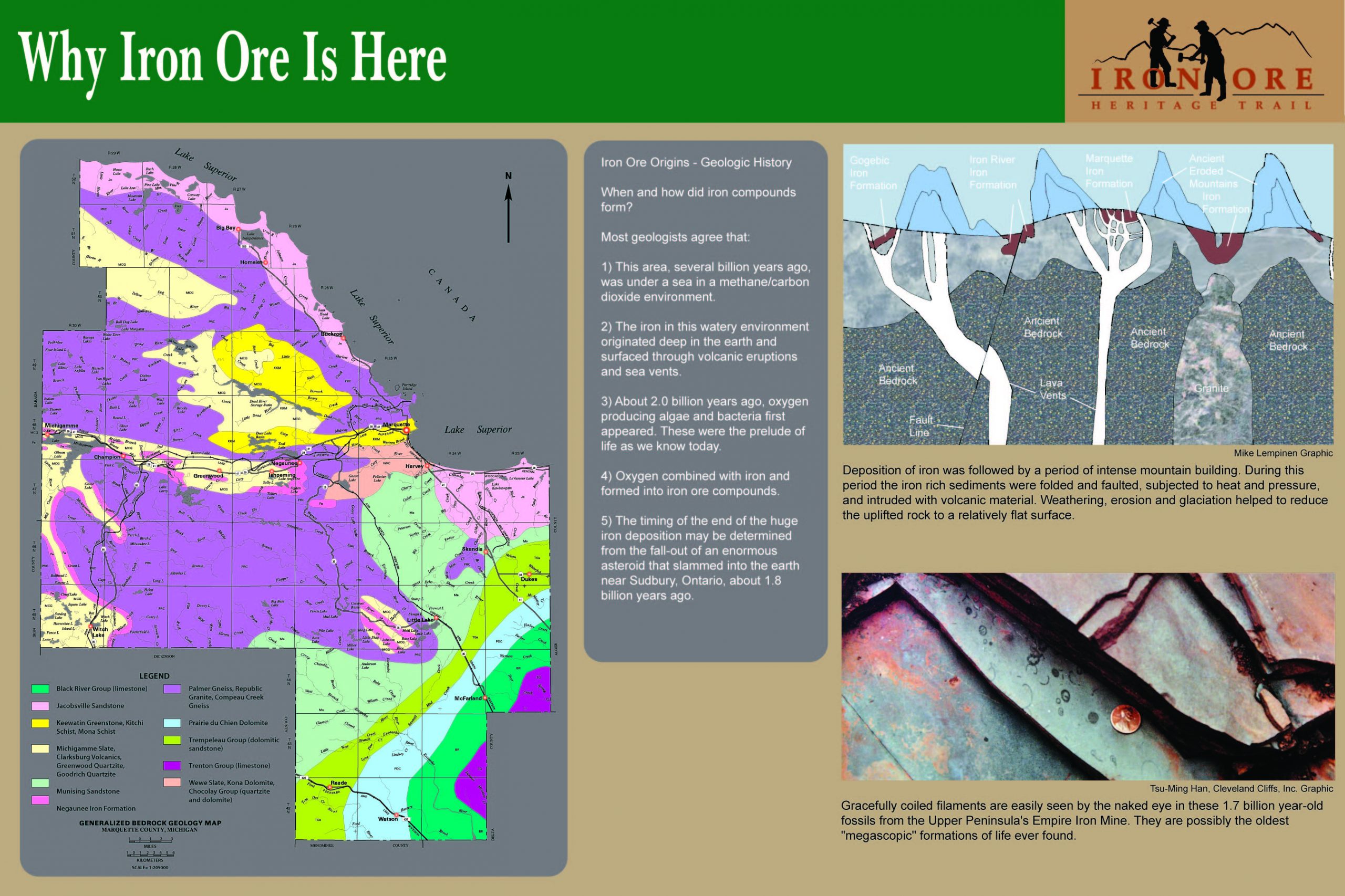
Why Iron Ore Is Here– When and How Did Iron Compounds Form?
Deposition of iron was followed by a period of intense mountain building. During this period the iron rich sediments were folded and faulted, subjected to heat and pressure, and intruded with volcanic material. Weathering, erosion and glaciation helped to reduce the uplifted rock to a relatively flat surface. This sign is located near mile marker 22, behind the Brownstone Buildings in Ishpeming.